
For most of us, losing GPS means circling a parking lot while our phone insists the coffee shop is “just ahead” in the middle of a brick wall. For the U.S. Air Force, losing GPS is a much bigger problem. It can affect navigation, targeting, timing, coordination, communications, weapons, rescue missions, and the delicate art of putting very expensive aircraft exactly where they need to be.
That is why the Air Force has spent years training for what many defense planners call a GPS-denied environment. In plain English: a battlefield where satellite navigation is jammed, spoofed, degraded, blocked, or simply cannot be trusted. During major exercises such as Red Flag at Nellis Air Force Base, aircrews have rehearsed what happens when the familiar blue dot disappears. The headline version says the Air Force “turned off GPS.” The more accurate version is a little less sci-fi but far more interesting: the military created controlled GPS interference so pilots, planners, maintainers, and commanders could practice fighting without depending on satellite navigation like it was a magical flying babysitter.
What Actually Happened During the GPS-Denied Exercise?
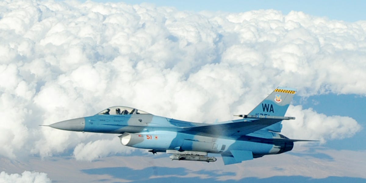
In 2018, Red Flag 18-1 became one of the most widely discussed examples of GPS-denied training in the continental United States. Hosted at Nellis Air Force Base in Nevada, Red Flag is one of the Air Force’s premier combat training exercises. It brings together fighter, bomber, tanker, intelligence, surveillance, reconnaissance, space, cyber, and command-and-control forces in realistic large-scale scenarios.
Red Flag 18-1 ran from January 26 to February 16, 2018, and Nellis described it as the largest Red Flag ever at the time, with a strong focus on strike-package operations. Participants included U.S. forces and close allies, including the Royal Air Force and Royal Australian Air Force. In other words, this was not a casual “let’s see what happens” afternoon. This was a rehearsed, coordinated, high-end combat simulation designed to stress the force before an adversary does it for real.
The GPS-denial component mattered because modern airpower is deeply connected to position, navigation, and timing, often shortened to PNT. GPS does not merely tell pilots where they are. It supports synchronized operations, precision weapons, route planning, rescue coordination, data links, and the timing backbone of many digital systems. Take it away, and the Air Force has to prove that it can still fly, fight, refuel, communicate, find targets, avoid threats, and come home without turning the mission into a very loud scavenger hunt.
No, the United States Did Not Shut Down the Entire GPS Constellation
Let’s clear up the big misconception before it starts doing push-ups in the corner. The U.S. government did not switch off the global GPS constellation. GPS.gov states that since GPS became operational in 1995, it has never been deactivated for military purposes. The system is a global public utility owned by the U.S. government and used by civilians, businesses, airlines, farmers, emergency responders, financial systems, and militaries around the world.
So what does “turning off GPS” mean in this context? It usually means localized or regional GPS interference testing, jamming, or simulated denial. Instead of shutting down satellites, the military creates conditions in which receivers in a particular area may lose, distrust, or struggle with GPS signals. Think of it less like turning off the sun and more like pulling the curtains during a training drill.
This distinction matters. GPS signals arrive at Earth from satellites thousands of miles away, and by the time they reach a receiver, they are extremely weak. That weakness makes GPS useful but vulnerable. A strong local jammer can overpower the satellite signal in a limited area. Spoofing is sneakier: instead of blocking the signal, it feeds receivers false positioning data. Jamming says, “You can’t see.” Spoofing says, “Sure, you can seeplease enjoy this completely wrong map.”
Why the Air Force Trains Without GPS
The Air Force trains without GPS because adversaries have noticed something obvious: the United States is very good at precision warfare, and GPS helps make that possible. If an enemy can degrade GPS, it can slow decision-making, reduce weapon accuracy, disrupt logistics, confuse aircraft, complicate search-and-rescue operations, and force commanders to spend precious time verifying what their systems are telling them.
Russia and China have invested heavily in electronic warfare, counterspace capabilities, jamming, spoofing, cyber operations, and anti-satellite weapons. Meanwhile, real-world conflicts have shown that GPS interference is not a theoretical PowerPoint monster hiding under the briefing-room table. In Ukraine, electronic warfare has shaped drone operations, guided weapons, artillery targeting, and battlefield movement. In Europe and the Middle East, aviation authorities have reported rising incidents of GNSS interference, including jamming and spoofing. The military lesson is blunt: if your plan requires perfect GPS, your plan is wearing flip-flops to a knife fight.
What Pilots Use When GPS Goes Dark
When GPS becomes unreliable, aircrews do not simply shrug and ask the nearest cloud for directions. Military aircraft are built with multiple layers of navigation. These may include inertial navigation systems, radar, radio navigation aids, terrain references, visual checkpoints, mission planning tools, celestial techniques in some contexts, datalinked information, and assistance from air traffic control or command-and-control assets.
Inertial Navigation Systems
An inertial navigation system, or INS, uses accelerometers and gyroscopes to estimate position based on movement from a known starting point. Unlike GPS, it does not need satellites. The downside is drift: small errors can grow over time. That is why GPS and INS often work together. GPS updates the system, and INS keeps things moving when satellite signals are lost. If GPS is the friend who always checks the map, INS is the friend who says, “I remember where we parked,” and is usually rightbut should occasionally be verified.
Radio Navigation and Ground-Based Aids
Civilian pilots still train on radio navigation systems such as VORs and instrument procedures that do not rely solely on GPS. Military aircraft can also use a range of onboard and external aids. During GPS interference events, civilian aircraft may be rerouted, assigned non-RNAV procedures, or supported by air traffic control vectors. That is why these exercises require coordination with the FAA and aviation stakeholders. Training for war should not accidentally turn Wednesday’s airline schedule into interpretive dance.
Human Skill Still Matters
One of the most important backups is not a gadget. It is training. Aircrews must understand how to recognize bad data, cross-check instruments, compare systems, communicate uncertainty, and execute mission plans when the digital environment becomes unreliable. A GPS-denied exercise forces crews to stop treating technology as a vending machine that always drops the snack. Sometimes the snack gets stuck. Sometimes the vending machine lies.
Why Red Flag Is the Right Place to Break Comfortable Habits
Red Flag exists to make aircrews uncomfortable before combat does. The exercise was created to expose pilots and mission crews to complex threats, large-force coordination, and realistic stress. At Nellis and the Nevada Test and Training Range, aircraft can train over vast airspace with simulated enemy air defenses, electronic threats, opposing forces, and complex mission objectives.
That environment is ideal for GPS-denied training because losing GPS is not a single problem. It is a chain reaction. Navigation becomes harder. Timing becomes less certain. Weapons may need alternative guidance. Tanker rendezvous planning becomes more demanding. Rescue missions become more complicated. Commanders must decide what information to trust. The entire force learns whether its procedures are resilient or just beautifully formatted wishful thinking.
The Civilian Side: Why Pilots Care About Military GPS Testing
Military GPS interference testing can affect civilian aviation, especially when the testing footprint extends beyond restricted airspace. FAA notices and flight advisories warn pilots when GPS may become unreliable or unavailable in certain areas, altitudes, and time windows. AOPA and other aviation groups have raised concerns about the safety and efficiency effects of repeated interference events, especially as aviation has grown more dependent on GPS-based navigation and ADS-B.
The good news is that commercial and general aviation are not supposed to depend on GPS alone. Aircraft procedures, air traffic control, radio navigation, inertial systems, and backup routes are part of the safety net. The less cheerful news is that GPS has become so convenient and widespread that losing it can still create delays, reroutes, workload spikes, and cockpit confusion. For pilots, “GPS unavailable” is not the end of the world, but it is the beginning of a busier day.
GPS Modernization: Stronger Signals, Still Not a Magic Shield
The United States is modernizing GPS to make it more resilient. Military M-code is designed to improve jam resistance, anti-spoofing protection, and secure access for warfighters. GPS III satellites add improved capabilities, and the Space Force continues to work on modernized PNT architecture. The goal is not to abandon GPS but to make it harder to deny and easier to supplement.
Still, modernization is not the same as invincibility. GAO reports have noted delays and integration challenges in fielding M-code across satellites, ground control, and user equipment. A satellite signal can be stronger and more secure, but receivers, aircraft, weapons, vehicles, and troops all need compatible equipment. In defense technology, the future often arrives in pieces, usually with a spreadsheet, a budget hearing, and three acronyms nobody invited.
Alternative PNT: The Search for Backup Plans
The Air Force and broader Department of Defense are exploring alternative ways to navigate when GPS is degraded. These include magnetic navigation, vision-based navigation, celestial references, signals of opportunity, terrain matching, improved inertial systems, resilient timing sources, and artificial intelligence that can help interpret messy sensor data.
One notable example involves Air Force experimentation with AI-assisted magnetic navigation on a C-17. Earth’s magnetic field can provide navigational clues, but aircraft generate electromagnetic noise, and the environment is complex. AI can help separate useful signals from clutter. That does not mean pilots will soon fly by “vibes and magnets,” but it shows the direction of travel: more layers, more cross-checks, and fewer single points of failure.
What a War Without GPS Could Look Like
A conflict with a sophisticated adversary would probably not produce a clean, Hollywood-style moment where every GPS screen goes black at once. It would be messier. Some areas might be jammed. Others might be spoofed. Some aircraft might receive reliable signals while nearby systems see errors. Timing data could be disrupted. Drones might wander. Precision weapons might need different guidance modes. Logistics units might have to confirm routes with old-school discipline. Commanders would face a constant question: “Is this information true?”
That uncertainty is the real weapon. GPS denial is not only about making people lost. It is about making them doubt, slow down, double-check, reroute, waste fuel, miss timing windows, and lose confidence in systems that normally feel automatic. In combat, seconds matter. Confusion is expensive. A GPS-denied force must be able to keep moving while everyone else is still arguing with the map.
Lessons for the Future of Airpower
The Air Force’s GPS-denied training points to a larger truth about modern war: convenience creates dependence, and dependence creates targets. GPS is one of the greatest military and civilian technologies ever fielded, but its success has made it irresistible to attack. The answer is not to throw away GPS. The answer is to train as if it may be contested, build systems that can operate through interference, and make sure humans know what to do when the screen stops being helpful.
Future airpower will rely on layered resilience. That means better GPS, improved anti-jam antennas, M-code receivers, inertial backups, AI navigation tools, electronic warfare awareness, alternative timing sources, disciplined mission planning, and crews who can operate when the digital world becomes foggy. The Air Force is not rehearsing a GPS-free war because it wants to go backward. It is rehearsing because the future battlefield may be so technologically contested that old and new skills must work together.
Experience-Based Perspective: What GPS-Denied Training Teaches Beyond the Cockpit
Imagine preparing for a road trip and being told that, halfway through, your phone map may stop working, your car’s navigation may show a false location, road signs may be missing, and someone may occasionally shout incorrect directions from the back seat. That is a tiny, non-lethal version of the GPS-denied mindset. The first lesson is humility. Technology is powerful, but it is not a substitute for understanding the route, the mission, and the backup plan.
In aviation and military operations, GPS-denied training forces people to rediscover fundamentals. Pilots must cross-check instruments. Mission commanders must plan branches and sequels. Intelligence teams must think about how targets are identified without perfect coordinates. Tanker crews must manage timing and rendezvous points with extra discipline. Maintenance teams must understand which systems depend on GPS and which can operate independently. Even communications teams must think about timing, synchronization, and electronic attack. GPS denial is not one person’s problem; it is a team sport, like football, except the ball is invisible and possibly being jammed.
The experience also teaches calm. When a trusted system fails, inexperienced teams tend to freeze, overcorrect, or chase bad information. Trained teams slow down just enough to verify. They compare sources. They ask whether the aircraft is wrong, the map is wrong, the signal is wrong, or the assumption is wrong. That habit is valuable far beyond the Air Force. Emergency managers, ship crews, drone operators, hikers, delivery networks, and even ordinary drivers can learn from it: always know what you will do if the easy tool fails.
There is also a cultural lesson. For decades, precision technology encouraged a belief that war could be made neat, clean, and perfectly synchronized. GPS-denied exercises puncture that illusion in a useful way. They remind commanders that war is friction, weather, deception, broken equipment, tired people, and enemies who get a vote. The best forces are not the ones that assume everything will work. They are the ones that keep functioning when important things do not.
Finally, GPS-denied training builds confidence. Not the loud kind that wears sunglasses indoors, but the quiet kind that comes from practicing failure. Aircrews who have already flown through degraded navigation conditions are less likely to panic if it happens in combat. Planners who have watched a schedule bend under electronic attack are more likely to build flexible timelines. Technicians who understand system dependencies are more likely to spot weak links before they matter. The entire organization becomes harder to surprise.
That is the real point of the Air Force rehearsing a war without GPS. It is not nostalgia for paper maps or a secret desire to make pilots do math at high speed, though both may occur. It is preparation for a battlefield where the invisible signals holding modern operations together may be attacked first. GPS-denied training says: if the blue dot disappears, the mission does not disappear with it.
Conclusion
The Air Force’s decision to rehearse operations without reliable GPS is not a gimmick. It is a serious response to a serious vulnerability. From Red Flag to newer Pacific-focused exercises, the service is learning how to operate when satellites are jammed, spoofed, degraded, or threatened. The lesson is clear: GPS remains essential, but dependence without resilience is dangerous.
Modern airpower will still use GPS because GPS is extraordinarily useful. But tomorrow’s winning force will be the one that can fight through interference, verify its data, navigate by multiple methods, and keep operating when the digital comfort blanket gets yanked away. In a future war, the side that survives may not be the side with the fanciest map. It may be the side that knows what to do when the map lies.