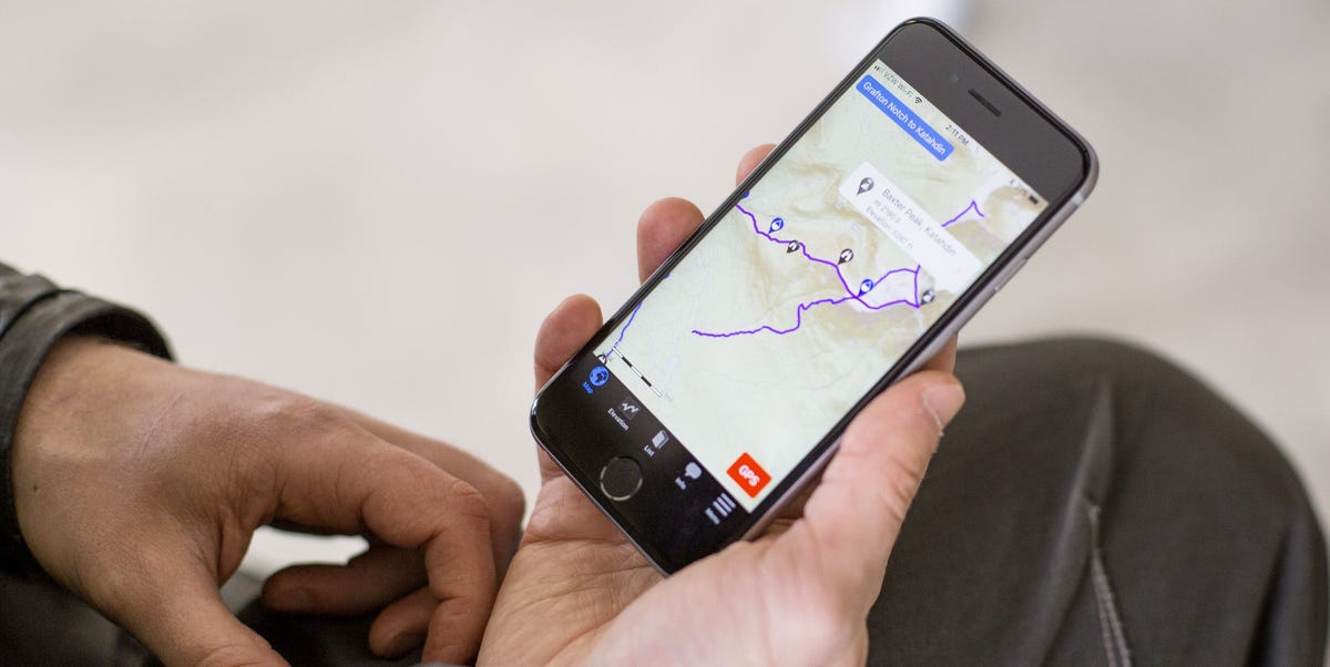

Getting lost outdoors sounds romantic only in movies. In real life, it usually involves wet socks, a dying phone battery, and someone confidently saying, “I think the trail is this way,” while pointing toward a suspiciously steep hill. That is where the best GPS apps for the outdoors become more than digital toys. They help hikers, backpackers, trail runners, cyclists, paddlers, hunters, skiers, and weekend wanderers plan routes, download offline maps, track progress, check elevation, mark waypoints, and return to the car without needing a search-and-rescue cameo.
Outdoor GPS apps are not all built for the same kind of adventure. Some are perfect for finding a local waterfall hike after brunch. Others are made for serious backcountry navigation, avalanche terrain, long-distance trails, or professional field work. The best GPS app depends on where you go, how far you travel, whether you have cell service, and how much map detail you actually need. A casual day hiker and a thru-hiker on the Pacific Crest Trail may both use GPS, but they are not asking the same questions.
This guide compares seven of the best GPS apps for outdoor use, including AllTrails, Gaia GPS, onX Backcountry, FarOut, CalTopo, Avenza Maps, and Komoot. Each app earns its place for a different reason: trail discovery, offline navigation, topographic mapping, route planning, long-distance trekking, or specialized outdoor layers. Think of this as your digital trailhead briefing, minus the mosquito cloud.
What Makes a Great Outdoor GPS App?
A strong outdoor GPS app should do more than show a blue dot on a green blob. For real outdoor use, the app should offer reliable offline maps, accurate GPS tracking, clear route planning, elevation data, waypoints, distance estimates, and easy-to-read maps. It should also work well when your phone has no signal, because nature has a funny habit of ignoring your carrier’s coverage map.
The best GPS apps for hiking and outdoor travel usually include several key features:
- Offline maps: Download maps before your trip so navigation works without cell service.
- Topographic detail: Contour lines, shaded relief, slope information, and elevation profiles help you understand terrain.
- Route planning: Create, import, or follow routes before and during your trip.
- GPS tracking: Record where you went, how far you traveled, and how much elevation you gained.
- Waypoints: Mark trailheads, campsites, water sources, scenic overlooks, or the spot where you dropped your snack bar.
- Safety tools: Wrong-turn alerts, live sharing, printable maps, weather layers, or backup export options can be extremely useful.
One important note: no GPS app should be your only navigation tool. Batteries die. Phones fall into streams. Screens crack. Apps glitch. A printed map, compass, downloaded backup map, power bank, and basic navigation skills are still part of smart outdoor travel. Technology is excellent; blind faith in technology is how people end up explaining themselves to park rangers.
Quick Comparison: 7 Best GPS Apps for the Outdoors
| GPS App | Best For | Standout Feature | Best User Type |
|---|---|---|---|
| AllTrails | Trail discovery and day hikes | Huge trail database with reviews and photos | Beginners, families, casual hikers |
| Gaia GPS | Backpacking and deep navigation | Powerful topographic maps and map layers | Backpackers, off-grid explorers |
| onX Backcountry | Backcountry routes and winter terrain | 3D maps, slope angle, and terrain tools | Skiers, hikers, hunters, mountain travelers |
| FarOut | Thru-hiking and long-distance trails | Trail-specific guides with water and campsite data | Long-distance hikers and backpackers |
| CalTopo | Advanced trip planning | Detailed layers, slope shading, and printable maps | Experienced hikers, SAR teams, planners |
| Avenza Maps | Offline professional maps | GeoPDF, GeoTIFF, and authoritative map support | Field workers, map nerds, remote travelers |
| Komoot | Turn-by-turn outdoor navigation | Voice guidance and route planning for multiple sports | Hikers, cyclists, runners, travelers |
1. AllTrails: Best GPS App for Finding Popular Trails
AllTrails is often the first outdoor GPS app people download, and for good reason. It is friendly, visual, and packed with trail suggestions. If you want to find a nearby hike with waterfalls, wildflowers, dog-friendly routes, family-friendly paths, or a “not too hard because I still have errands later” loop, AllTrails makes the search simple.
The biggest strength of AllTrails is trail discovery. You can browse routes by difficulty, length, elevation gain, rating, activity type, and location. User reviews and photos are especially helpful when deciding whether a trail is muddy, crowded, scenic, closed, or secretly a stair-climber machine disguised as a mountain path.
Best Features
- Large database of hiking, biking, running, and walking trails
- User reviews, photos, ratings, and recent trail condition notes
- GPS activity recording and route following
- Offline maps and wrong-turn alerts with paid plans
- Useful filters for dogs, kids, views, waterfalls, and difficulty
AllTrails is best for casual hikers, families, travelers, and anyone who wants a simple way to discover outdoor routes. It is less ideal for serious off-trail navigation or complex backcountry planning. Trail data can also vary because much of it depends on community contributions. That does not make it bad; it just means you should double-check important details before committing to a route.
2. Gaia GPS: Best GPS App for Backpacking and Backcountry Maps
Gaia GPS is one of the strongest outdoor GPS apps for people who care about map detail. It is popular with backpackers, overlanders, hunters, trail runners, and backcountry travelers who want more than a simple trail line. Gaia GPS offers topographic maps, route creation, GPS tracking, waypoints, offline downloads, weather overlays, public land information, and a large map catalog.
For multi-day backpacking trips, Gaia GPS feels more like a serious navigation system than a casual hiking app. You can plan a route on the web, sync it to your phone, download offline maps, and use GPS to follow your location in the field. It is especially useful in remote places where trails may be faint, unsigned, or confusing.
Best Features
- Detailed topographic maps and multiple map layers
- Offline map downloads for remote areas
- Waypoints, route planning, and GPS track recording
- Weather, camping, public land, and terrain information
- Good balance between power and usability
Gaia GPS is best for backpackers and advanced hikers who want dependable offline navigation and richer map detail. The learning curve is higher than AllTrails, but the reward is greater control. If AllTrails is the friendly guide at the visitor center, Gaia GPS is the quiet map expert who knows where every ridge, drainage, and campsite might be hiding.
3. onX Backcountry: Best GPS App for Mountain Terrain
onX Backcountry is designed for people who travel in rugged terrain and want to understand the land before stepping into it. The app is especially useful for hikers, backpackers, backcountry skiers, splitboarders, and mountain travelers. It includes offline maps, 3D terrain, slope angle, slope aspect, route planning, GPS tracking, waypoints, and weather-related tools.
Where onX Backcountry really stands out is terrain visualization. Being able to study a route in 3D, look at slope steepness, and understand elevation gain can help you make better decisions before and during a trip. For winter travel, slope angle information can be especially important because steep terrain is a key part of avalanche awareness. Of course, an app does not replace avalanche education, forecasts, or judgment, but it can support smarter planning.
Best Features
- Offline 3D maps and detailed terrain visualization
- Slope angle and slope aspect layers
- Route planning with distance and elevation data
- Waypoints and GPS tracking
- Useful for both summer trails and winter backcountry travel
onX Backcountry is best for hikers, skiers, and mountain users who want terrain intelligence. It may be more app than a beginner needs for a paved nature loop, but for alpine hikes, ridgeline routes, snow travel, or remote trail planning, it is a serious contender.
4. FarOut: Best GPS App for Thru-Hiking
FarOut, formerly known by many hikers as Guthook, is built for long-distance trail life. It is one of the best GPS apps for thru-hikers and backpackers following established long trails. Instead of being a general map app first, FarOut functions like a GPS-enabled guidebook. It focuses on trail-specific details such as water sources, campsites, resupply points, shelters, road crossings, elevation profiles, and community updates.
For trails like the Appalachian Trail, Pacific Crest Trail, Continental Divide Trail, and many other long-distance routes, this kind of information can be priceless. Knowing that the next water source is dry, the campsite is crowded, or the next town stop has limited food options can change your day. Sometimes it can change your feet’s opinion of you, too.
Best Features
- Trail-specific GPS guides for hiking, biking, and paddling routes
- Offline map use on supported guides
- Water sources, campsites, shelters, and resupply details
- Elevation profiles and mileage markers
- Community comments and real-time trail updates
FarOut is not the best choice for discovering random local hikes. It is best when you already know the trail or route you plan to follow. For thru-hikers, section hikers, and long-distance backpackers, however, it can become the app you open more often than your food bag.
5. CalTopo: Best GPS App for Advanced Planning
CalTopo is a powerful mapping platform with a mobile app that appeals to serious planners, backcountry travelers, search-and-rescue users, and anyone who loves map layers the way some people love coffee. It offers detailed topographic tools, slope angle shading, route creation, offline map layers, weather-related overlays, shared maps, and printable map options.
One of CalTopo’s biggest advantages is pre-trip planning. On a desktop, you can build detailed routes, study terrain, print maps, analyze slope angles, and organize alternate options before syncing data to your phone. For remote trips, this is extremely helpful. If the weather changes, a river crossing looks unsafe, or your original route becomes unrealistic, having alternate lines already mapped can save time and stress.
Best Features
- Excellent map layers for topographic planning
- Slope angle shading and terrain analysis
- Offline maps with paid plans
- Printable maps for backup navigation
- Shared maps for teams and group planning
CalTopo is best for experienced hikers, mountaineers, backcountry skiers, guides, and outdoor professionals. Beginners may find it more technical than necessary at first. But if you enjoy planning routes carefully and want a tool that can grow with your skills, CalTopo is one of the most capable GPS apps available.
6. Avenza Maps: Best GPS App for Offline Professional Maps
Avenza Maps takes a different approach from most outdoor GPS apps. Instead of focusing mainly on community trail databases or route discovery, it specializes in offline maps from trusted publishers and map formats such as GeoPDF and GeoTIFF. This makes it useful for hikers, hunters, field workers, land managers, geologists, forestry crews, paddlers, and anyone who needs specific authoritative maps.
The app can show your GPS location directly on downloaded maps without cell service. That is especially helpful when using official park maps, public land maps, trail association maps, or custom professional maps. If you already know which map you need, Avenza can be incredibly practical.
Best Features
- Offline GPS location on downloaded maps
- Support for GeoPDF, GeoTIFF, and custom map imports
- Access to a large digital map store
- Useful for official, professional, and specialty maps
- Great for fieldwork and remote navigation
Avenza Maps is not the flashiest app on this list, but it is one of the most practical for map-first users. If your adventure depends on a specific official map rather than a general trail database, Avenza deserves a place on your phone.
7. Komoot: Best GPS App for Turn-by-Turn Outdoor Navigation
Komoot is a route-planning and navigation app built for hikers, cyclists, mountain bikers, runners, and travelers. Its biggest strength is guided navigation. You can plan a route, download it for offline use, and follow turn-by-turn voice guidance. This is especially useful when you want to keep moving without staring at your screen every thirty seconds like it owes you money.
Komoot is excellent for mixed outdoor travel, especially in areas with networks of trails, paths, bike routes, and roads. It helps you plan based on activity type and surface, then gives navigation prompts along the way. For cyclists and hikers who like planned routes with clear guidance, Komoot is a polished and enjoyable option.
Best Features
- Turn-by-turn voice navigation
- Offline maps by region
- Route planning for hiking, cycling, running, and mountain biking
- Surface and terrain information
- Good integration with some GPS devices and wearables
Komoot is best for people who want smooth route planning and guided navigation, especially for day trips, bike tours, and travel adventures. It may not replace Gaia GPS or CalTopo for complex backcountry mapping, but it is one of the easiest GPS apps to actually follow while moving.
How to Choose the Best GPS App for Your Adventure
Choosing the best outdoor GPS app is less about finding the “winner” and more about matching the tool to the trip. For local hikes and trail ideas, AllTrails is hard to beat. For backpacking, Gaia GPS offers more map power. For mountain terrain and snow travel, onX Backcountry brings valuable terrain tools. For long-distance trails, FarOut is the guidebook you can carry in your pocket. For detailed route planning, CalTopo is excellent. For official offline maps, Avenza Maps shines. For voice-guided outdoor routes, Komoot is smooth and practical.
Here is a simple way to decide:
- Choose AllTrails if you want easy trail discovery and community reviews.
- Choose Gaia GPS if you need serious offline topographic navigation.
- Choose onX Backcountry if terrain visualization and slope tools matter.
- Choose FarOut if you are hiking a long-distance trail.
- Choose CalTopo if you love detailed planning and printable maps.
- Choose Avenza Maps if you need official or custom offline maps.
- Choose Komoot if you want turn-by-turn route guidance.
Many experienced outdoor users combine apps. For example, a backpacker might plan with CalTopo, navigate with Gaia GPS, and carry a printed map as backup. A thru-hiker might rely on FarOut for water updates but still keep a broader topo map downloaded. A mountain biker might use Komoot for route planning and Trailforks as an extra trail condition resource. The smartest setup is often not one app; it is a small navigation system that fits your actual trip.
Practical Tips for Using GPS Apps Outdoors
Before leaving home, download your maps, route, and any needed layers. Do not wait until the trailhead, because “one bar of service” is the outdoor equivalent of a false promise. Open the map after downloading to make sure it works offline. Turn on airplane mode during the hike to save battery, then enable GPS location as needed. Most modern smartphones can still use GPS in airplane mode, but maps must already be stored on the device.
Bring a power bank on long trips, especially if you record tracks, use live location sharing, take photos, or run navigation all day. Cold weather drains batteries faster, so keep your phone warm in winter. Lower your screen brightness, close unnecessary apps, and avoid constant screen checking. Your GPS app is a tool, not a social media feed with contour lines.
Always compare app mileage and elevation estimates with official trail information when possible. Different apps may calculate distances slightly differently. User-generated routes can include detours, old trails, unofficial shortcuts, or “creative” lines that should not be followed. If a route looks suspicious, research it before going.
Finally, learn basic map reading. GPS is helpful, but understanding terrain is what turns navigation from button-tapping into decision-making. Know how to identify ridges, valleys, trail junctions, water crossings, contour spacing, and escape routes. A good app can show you where you are; outdoor judgment helps you decide where you should go.
Outdoor GPS App Experiences: What Real Use Teaches You
After using GPS apps outdoors, one lesson becomes clear very quickly: the best app is the one you understand before you need it. Downloading a powerful navigation app five minutes before a hike is like buying a musical instrument and expecting to perform jazz by lunch. The app may be excellent, but you still need practice.
For a simple local hike, AllTrails often feels like the easiest starting point. You can scan reviews, check recent photos, and see whether the trail is muddy, icy, crowded, or closed. That kind of community feedback is genuinely useful. For example, if several hikers mention that a creek crossing is high after rain, you can choose another route or bring better footwear. The downside is that popular trails can make people overconfident. A five-star review does not guarantee easy navigation, good weather, or safe conditions.
On backpacking trips, Gaia GPS and CalTopo feel more reassuring because they give a wider view of the landscape. You are not just following a line; you are reading the terrain. When a trail disappears under leaves, snow, or poor maintenance, topo lines and waypoints become more important than star ratings. Gaia GPS is excellent in the field, while CalTopo is outstanding for planning before the trip. Together, they make a strong combination for hikers who like to know what is around the next ridge before their legs find out the hard way.
FarOut is a different kind of experience. On a long trail, the questions are practical: Where is the next water? How far to camp? Is the next road crossing useful for resupply? Are other hikers reporting problems? FarOut answers those questions better than a general GPS app because it is built around trail life. It feels less like a map and more like a pocket-sized trail community.
onX Backcountry becomes valuable when terrain complexity increases. In mountain areas, 3D views and slope tools can make a route easier to understand before you commit to it. This is especially helpful when planning winter routes or evaluating steep approaches. A slope layer does not make decisions for you, but it gives you information that can slow down bad ideas before they become exhausting ones.
Avenza Maps is the app that often earns respect quietly. It may not feel as social or modern as some competitors, but when you have the exact official map you need downloaded and your GPS dot appears on it offline, the usefulness is obvious. For national forests, state parks, paddling routes, and professional field maps, this can be a lifesaver.
Komoot shines when you want guided movement instead of constant map checking. Voice navigation is great for cycling, running, or hiking routes with frequent turns. It keeps your phone in your pocket and your attention on the world around you, which is supposedly the reason we go outside in the first place.
The biggest personal takeaway is simple: test your GPS app on an easy route before trusting it on a hard one. Learn how to download maps, start navigation, mark a waypoint, follow a track, export a route, and find your location offline. Do this on a neighborhood walk or short trail, not halfway up a mountain while thunder is auditioning for a drama award. Outdoor GPS apps are incredibly useful, but preparation is what makes them dependable.
Conclusion: The Best GPS App Is the One That Fits Your Trip
The best GPS apps for the outdoors all solve slightly different problems. AllTrails helps you find hikes. Gaia GPS helps you navigate serious terrain. onX Backcountry helps you understand mountains. FarOut supports long-distance trail life. CalTopo gives advanced planners deep map control. Avenza Maps puts official offline maps in your pocket. Komoot makes turn-by-turn outdoor navigation simple.
If you are new to outdoor GPS apps, start with AllTrails or Komoot for easy discovery and navigation. If you are moving into backpacking or remote areas, add Gaia GPS or CalTopo. If you hike long trails, use FarOut. If you need official maps, choose Avenza. If you travel in steep terrain, study onX Backcountry. The right app will not carry your pack, filter your water, or convince your knees that downhill hiking is fun, but it can help you travel smarter and safer.
Note: GPS apps are powerful tools, but they should not replace common sense, physical maps, compass skills, weather awareness, or backup power. Download maps before leaving cell service, tell someone your plan, and always give yourself enough daylight to make good decisions.