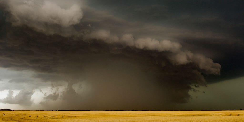

A derecho sounds like one of three things: a legal term, a fancy appetizer, or the name of a racehorse that definitely has opinions. In reality, it is one of the atmosphere’s most dramatic ways to remind us that wind is not just “air having a moment.” A derecho is a fast-moving, long-lived windstorm tied to a band of severe thunderstorms, and when one barrels through, it can flatten trees, shred crops, knock out power for days, and leave entire communities staring at their patios like they just lost an argument with nature.
Because tornadoes get the movie scenes and hurricanes get the headlines, derechos often slip under the radar in everyday conversation. That is a mistake. These storms can be every bit as destructive in their own way, especially because they can impact an enormous stretch of land in a matter of hours. If you have ever heard the phrase “straight-line wind damage,” you were already in derecho territory.
This guide breaks down what a derecho is, how it forms, why meteorologists take it seriously, how it differs from tornadoes and hurricanes, and what you should do if one is headed your way. Think of it as your no-nonsense, low-jargon field guide to one of America’s nastiest severe weather events.
What Is a Derecho?
A derecho is a widespread, long-lasting windstorm associated with a line or cluster of rapidly moving thunderstorms. The word comes from Spanish and means “straight” or “direct,” which makes sense because the signature damage is usually caused by straight-line winds instead of rotating winds like those in a tornado.
That difference matters. A tornado tends to carve a narrower, more concentrated path with twisting damage. A derecho, by contrast, can sweep across hundreds of miles and damage huge areas with powerful gusts that blow in roughly the same direction. In other words, a tornado is a surgical strike from the sky. A derecho is the atmosphere grabbing a very large rake and dragging it across multiple states.
To qualify as a derecho, the storm system generally needs to produce a long swath of damaging winds over a large distance, with severe gusts occurring along much of that path. These are not your average summer storm breezes that knock over one sad lawn chair. Derechos can produce winds in the 60 to 100 mph range or higher in extreme cases, which is why people sometimes compare them to inland hurricane-force events.
How Does a Derecho Form?
A derecho usually develops from a line of thunderstorms that organizes and strengthens as it moves. On radar, meteorologists often look for a bow echo, which is exactly what it sounds like: a line of storms that bows outward like an archer got extremely committed. That bowing shape is a clue that strong winds are pushing forward at the leading edge of the storm.
Here is the basic setup. Thunderstorms produce rain-cooled air that rushes downward and outward when it hits the ground. That outflow, called a gust front, can lift warm, moist air ahead of the storm and trigger new thunderstorm development. When the atmosphere has the right combination of heat, moisture, instability, and stronger winds aloft, the process can feed on itself. The result is a thunderstorm complex that not only survives but accelerates, producing widespread damaging winds for hours.
In plain English, a derecho forms when thunderstorms become organized enough to build their own momentum and keep manufacturing fresh storms out front. It is less like one storm cell getting angry and more like an entire weather assembly line deciding to work overtime.
The Main Types of Derechos
Meteorologists generally describe three main types of derechos: progressive, serial, and hybrid.
Progressive derechos are often the summer troublemakers. They tend to move quickly and are frequently associated with compact bow echoes. These are the storms that can explode in hot, unstable weather and race along the edge of a high-pressure ridge.
Serial derechos are more often tied to larger-scale weather systems, such as strong cold fronts. They can involve longer lines of storms and may be more common in cooler seasons. They also sometimes come with a higher chance of brief tornado spin-ups embedded within the line.
Hybrid derechos do what hybrid things usually do: borrow characteristics from both. Nature, as always, enjoys refusing to stay inside neat categories.
Derecho vs. Tornado vs. Hurricane
People often hear about wind damage and immediately think tornado or hurricane. That is understandable. It is also a good way to lose points on a weather quiz.
Derecho vs. Tornado
The biggest difference is rotation. Tornadoes are rotating columns of air, and their damage patterns often look chaotic or convergent, with debris thrown in different directions. Derechos are mainly driven by straight-line winds, so trees, poles, and debris are often pushed the same way over a broad area.
That does not mean a derecho is “just a thunderstorm.” It can be far more widespread than a tornado, and some derecho events can include embedded tornadoes. So yes, nature can absolutely multitask.
Derecho vs. Hurricane
Hurricanes are tropical cyclones that form over warm ocean water and can last for days. Derechos form over land within severe thunderstorm systems and typically unfold much faster. A hurricane is a massive rotating storm with a warm core and a long life cycle. A derecho is a convective windstorm powered by thunderstorms and atmospheric instability.
The comparison between the two usually comes down to impact. Some derechos can produce wind damage that feels hurricane-like on the ground, even though the meteorology behind them is completely different.
Derecho vs. an Ordinary Thunderstorm
An ordinary severe thunderstorm might damage one town, one county, or a few scattered neighborhoods. A derecho can damage communities across multiple states in a single day. Scale is the big difference. So is persistence. A derecho does not just arrive, flip over your recycling bin, and leave. It keeps going, and going, and going.
Where and When Do Derechos Usually Happen?
In the United States, derechos are most common from late spring into summer, with the warm season being peak derecho territory. They occur most often along two broad corridors: one from the upper Mississippi Valley into the Ohio Valley, and another from the southern Plains into the mid-Mississippi Valley.
That said, derechos are not locked into one zip code. They can affect parts of the Mid-Atlantic, the Southeast, and other regions when the setup is favorable. They are much rarer in the interior West, but “rare” in weather language does not mean “impossible,” and the atmosphere has a well-documented habit of ignoring human confidence.
Hot, humid air near the ground and stronger winds above are a classic recipe. That is one reason summer can be such a productive season for progressive derechos. The atmosphere stores a lot of energy, and once a triggering mechanism gets storms going, things can escalate quickly.
Why Are Derechos So Dangerous?
The danger of a derecho comes from reach, speed, and surprise.
First, the reach. These storms can leave a damage path hundreds of miles long and tens of miles wide. That means a single event can hit multiple metro areas, countless smaller communities, transportation corridors, power infrastructure, farms, and forests.
Second, the speed. Derechos often move quickly, which can reduce the time people have to react. If you are outdoors or on the road, that is bad news. Fast-moving storms can turn a normal afternoon into a full-blown emergency before people have finished debating whether the sky “looks weird.”
Third, the surprise factor. Tornadoes and hurricanes are familiar villains. Derechos are less well known, so some people underestimate them. But straight-line winds of 80 or 90 mph can topple large trees, peel roofs, damage buildings, flip high-profile vehicles, and trigger major power outages. In agricultural regions, the consequences can be brutal, flattening cornfields, damaging fruit and vegetable crops, and leaving economic losses that linger long after the sky clears.
Another concern is the aftermath. Downed power lines, blocked roads, damaged buildings, spoiled food, and dangerous generator use can all create secondary hazards. Sometimes the storm itself is only the opening act. Cleanup is where the sequel gets expensive.
Famous Derecho Events That Show Their Power
If the word derecho still feels abstract, history helps. Several major events have shown just how destructive these storms can be.
The June 29, 2012 derecho raced from the upper Midwest to the Mid-Atlantic in a matter of hours and produced widespread damage with numerous hurricane-force wind reports. It became one of the most memorable warm-season severe weather events in recent U.S. history, especially because it struck heavily populated areas and left millions without power during extreme heat.
The August 10, 2020 Midwest derecho tore across Iowa and beyond, devastating communities, flattening crops, and causing catastrophic tree loss. Cedar Rapids, Iowa, became one of the best-known examples of the storm’s long-term impact, with enormous canopy loss and a recovery process measured not in days but in years.
The July 15, 2024 derecho brought widespread damaging winds up to 100 mph across parts of Iowa, Illinois, and Indiana, again proving that derechos are not historical curiosities. They are current, dangerous, and fully capable of reshaping a day, a season, and a local economy.
How to Stay Safe During a Derecho
If a derecho is approaching, treat it with the same seriousness you would give any major severe weather threat.
Before the Storm
Pay attention to forecasts, watches, and warnings. Have multiple ways to receive alerts, including a weather app, local news, and NOAA Weather Radio if possible. Bring in or secure outdoor items that can become flying debris. Charge phones and backup batteries. Know where you will shelter if you are at home, at work, or traveling.
During the Storm
Go inside a sturdy building. Move to an interior room on the lowest floor and stay away from windows. Mobile homes are especially vulnerable in high winds, so move to a stronger shelter before the storm arrives if you can. If you are driving, do not park under trees or power lines, and avoid continuing through the worst of the storm unless you can safely reach a sturdy building.
Remember that damaging straight-line winds can send debris through windows and drop trees onto roads with almost no warning. This is not the time to stand on the porch filming “crazy weather content” for social media. Your followers will survive without your live commentary. You should also survive, which is the more important metric.
After the Storm
Watch for downed power lines and stay far away from them. Be careful around damaged buildings, broken tree limbs, and flooded or blocked roads. If the power is out and you use a generator, keep it outside and well away from doors, windows, and vents to prevent carbon monoxide poisoning. Use flashlights instead of candles when possible, and be cautious about spoiled food if the outage lasts for many hours.
Why More People Should Know This Word
Weather literacy matters. When people know what a derecho is, they are more likely to understand the forecast, take warnings seriously, and act fast. That matters because severe thunderstorm language can sound routine to people who hear it often. But “severe thunderstorm” can cover a wide range of impacts, and in a derecho setup, the wind risk can be extraordinary.
Knowing the term also helps people make sense of what they are seeing after the fact. If dozens of trees are down in the same direction across a huge area, if the power grid is shredded across multiple counties, and if the storm line roared through like a moving wall of wind, you are not looking at just another rainy afternoon. You are looking at a serious convective wind event with a name worth remembering.
Conclusion
A derecho is one of the most powerful and least appreciated storm types in the American weather playbook. It is not a tornado, not a hurricane, and definitely not a storm you shrug off because the word sounds unfamiliar. These systems can race across hundreds of miles, unleash destructive straight-line winds, cause long-lasting infrastructure and agricultural damage, and leave communities dealing with the consequences for weeks or even years.
The good news is that knowledge helps. If you understand what a derecho is, what conditions favor it, and how to respond when warnings are issued, you are already in a better position than the person standing outside saying, “Huh, it got windy all of a sudden.” In weather, that sentence rarely ends well.
Experiences Related to Derechos: What These Storms Can Feel Like
The following section is a composite, experience-based narrative inspired by commonly reported impacts from real derecho events. It is included to add lived-context perspective, not as a single firsthand account.
One of the strangest things about a derecho is how quickly an ordinary day can turn into something unforgettable. People often describe starting with a normal summer routine: a lunch break, errands, mowing the lawn, answering emails, wondering whether the clouds mean rain later. Then the sky changes. It does not always look cinematic right away. Sometimes it just darkens with unusual speed, as if someone yanked a giant shade across the sun. The air can feel heavy, tense, and oddly still for a moment before the wind arrives.
Then the gust front hits, and the mood changes instantly. Trees that looked solid and permanent begin whipping back and forth like they suddenly regret every life choice. Patio furniture scoots across decks. Trash cans roll away with surprising confidence. In stronger events, people hear a roar before they fully understand what is happening. It is not exactly thunder and not exactly a train, though many compare it to both. It sounds like the sky has switched to industrial mode.
Inside a home, the experience can be unnerving because the force feels broad and relentless. Windows rattle. Doors flex. Branches slam into siding or the roof. The lights flicker once, then maybe twice, and then the power gives up entirely. In neighborhoods with mature trees, the snapping and crashing outside can be more frightening than the rain. People often say the hardest part is not seeing a single rotating funnel to focus on. Instead, the threat feels everywhere at once. The whole outside world seems to be moving.
For drivers, a derecho can be even more disorienting. Visibility can plunge. Debris starts crossing the road. Traffic slows unevenly. You may realize in a split second that trees and power lines are now bigger hazards than the rain itself. That is part of what makes these storms so dangerous: they do not ask politely for your attention. They take it.
After the storm, the silence can feel almost as dramatic as the noise. People step outside and immediately understand this was not a routine thunderstorm. Branches are everywhere. Streets are blocked. Cars are damaged. Fences are down. The smell of fresh-cut wood hangs in the air because so many trees have been split or uprooted. In agricultural areas, fields that looked healthy hours earlier can be flattened. In towns and cities, the power outage becomes the next chapter of the experience: no air conditioning, no traffic lights, no internet, and a long line forming at the gas station that still has electricity.
There is also a mental side to these storms. People often remember the sound, the speed, and the feeling of helplessness. They talk about checking on neighbors, clearing limbs together, sharing generators safely, throwing out spoiled food, and realizing how much local life depends on trees, wires, roads, and routines that seem indestructible until they are not. In that sense, derechos are not just weather events. They are community stress tests. And if there is one lesson many survivors repeat, it is simple: when severe wind warnings are issued, do not wait around to see whether the storm earns a special label later. Take shelter first. You can learn the vocabulary after your roof is still attached.
SEO Tags